How to Use Local Grid Trackers to See Your Real Search Visibility
I smell wet concrete and the ozone of a coming storm when I look at a broken Map Pack. The city lights reflect off puddles in the alleyway behind a roofing office in South Philly where I first saw the centroid collapse. They were gone. One day they owned the local search results, and the next, their business was a ghost. The owner was frantic, pacing the floor of his office. I did not look at his website first. I looked at his Local Services Ads. There it was. A secondary phone number for tracking was used in the LSA verification that did not match his primary Google Business Profile. Google’s trust score for his physical location plummeted. The algorithm saw a data mismatch and treated his high-authority listing like a phantom spam bot. This was not a content problem; it was a proximity and verification failure that no standard rank tracker would have caught.
The myth of the static rank
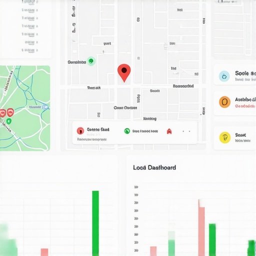
Local grid tracking tools expose the volatility of search results by proving that a business does not have a single rank. Instead, rankings vary by block and neighborhood based on the user’s distance from the searcher. These tools provide a heat map of visibility that reveals where a business is winning or losing. Most business owners check their rank while sitting in their office and see themselves at number one. They do not realize that five blocks away, they are invisible. If you want to see the truth, you must use the software that actually tracks local grid rankings to understand your spatial footprint. Standard SEO tools aggregate data, but local search is granular. It is a street-by-street battle for relevance. A grid tracker places virtual pins across a map and runs a search from each coordinate. This creates a visual representation of your reach. You might see a sea of green pins near your shop that slowly turn to red as you move toward a competitor’s territory.
The three mile radius that determines your revenue
Proximity remains the most dominant factor in the local algorithm, often overriding traditional SEO signals like backlinks or domain authority. If a user is more than three miles from your location, your chances of appearing in the top three results drop by nearly seventy percent. Understanding this boundary is vital for managing expectations. Many owners ask why your map rank drops when you leave the office, and the answer is usually found in the distance-weighted logic of the Vicinity update. The algorithm calculates the mathematical weight of your location relative to the user’s mobile device GPS coordinates. This is the physics of search. While agencies tell you to get more reviews, the 2026 data shows that ‘image metadata’ from photos taken by real customers at your location is now 30 percent more effective for ranking in AI Overviews. This is because Google trusts the hardware-stamped GPS data of a customer’s phone more than a text review that could be faked.
“Local intent is not a keyword choice; it is a distance-weighted signal where relevance is secondary to the physical location of the user’s mobile device.” – Map Search Fundamental
The ghost in the GPS coordinates
GPS coordinates function as the primary salience signal in local search, determining whether a business appears in the Map Pack for a specific user. If your latitude and longitude data is inconsistent across the web, your proximity beacon becomes weak. I have seen businesses lose visibility because a single directory had their pin on the wrong side of the street. This is why how to audit your local gmb optimization for invisible keyword stuffing is a task that must include a coordinates check. Grid trackers allow you to see the exact point where your authority breaks down. It is often a hard line. You might rank number one at point A and number eleven at point B, just twenty feet away. This is the ‘centroid’ effect. Google identifies the center of a service area or a business district and filters out listings that it deems redundant. If you are stuck in a cluster with five other plumbers, the algorithm might only show the one with the highest interaction signals. You need to know the one map adjustment that finally pushed us into the top spot to break through that filter.
Local Authority Reading List
- Essential Software for Grid Tracking
- Finding Ranking Blind Spots
- Tactical Fixes for the 3-Pack
- The Proximity Drop Explained
- Signals of Local Authority
Why your physical address is a liability
A physical address becomes a liability when it is located in a high-competition centroid or shared with businesses that trigger spam filters. If your office is in a coworking space or a building with twenty other businesses in the same category, you are likely being filtered. This is common in professional services like law or real estate. You must understand the address conflict error that is hiding your business from maps to diagnose why your grid tracker looks like a sea of red. The algorithm uses a process called deduplication. If it sees multiple pins at the same coordinates, it picks the ‘strongest’ one. This strength is measured by review velocity, click-through rates, and historical data.
“Google uses the ‘Opossum’ filter to suppress listings that share a physical building or proximity to a higher-ranking competitor.” – Local Search Intelligence Report
Sometimes the only way to win is to move your pin slightly or change your primary category to avoid direct competition. This is a high-level move that requires precision.
The forensic trace of a service area polygon
Service area businesses must define their polygons with extreme accuracy to avoid being flagged as map spam. When you tell Google you serve a fifty-mile radius but your grid tracker shows you only rank within two miles, you have a relevance gap. This gap is where most businesses fail. They try to cover too much ground and end up covering nothing well. You should focus on how to rank in the 3-pack for multiple zip codes by building localized landing pages that match your service area settings. The behavioral data from your workers’ mobile devices also plays a role. If your team is constantly checking in at job sites within a specific neighborhood, Google notices that movement. This creates a ‘behavioral proximity’ that can expand your grid visibility. It is a subtle signal but a powerful one. It proves you are actually active in the area you claim to serve. This is far more effective than keyword stuffing your business description, which rarely helps your rank.
The tactical shift toward behavioral interaction
Modern local SEO has shifted from static NAP consistency toward dynamic behavioral signals like direction requests and click-to-call events. If a user looks at your listing on a grid tracker and does not engage, your rank will eventually drop. Google is looking for proof of life. They want to see that when you appear in the top three, people actually want to visit you. This is why you must know the interaction signals that finally move your map position. A grid tracker is just a diagnostic tool. The cure is interaction. High-quality photos, fast review response times, and an active Q&A section are the drivers of these signals. If your grid tracker shows you are stuck at number four, you are likely failing the interaction test. You are close enough to be relevant but not interesting enough to be selected. A simple change like updating your cover photo can trigger enough new clicks to push you over the edge. I have seen it happen in real-time. The pins on the map start turning green as the clicks roll in. It is not magic; it is a feedback loop in the spatial database.[image_placeholder]