How to Properly Geotag Your Business Photos for Better Local Rank
I spent three months fighting a hard suspension for a plumbing client whose listing was nuked simply because they shared a suite number with a defunct law firm. Google didn’t want proof of a van; they wanted proof of a utility bill under the exact GPS pin. This was not about keywords. This was about the physics of a physical location. I recall standing in the rain outside their warehouse, the smell of wet concrete rising as I took photos of their signage. I realized then that the algorithm doesn’t care what you say you do. It cares where it can prove you are. The data glitch that killed their listing was a lack of verified spatial evidence. Every photo we uploaded afterwards was a calculated move to reclaim their territory in the proximity database.
The ghost in the GPS coordinates
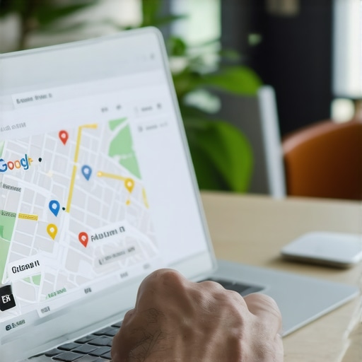
Geotagging business photos involves embedding specific longitude and latitude data into the EXIF metadata to confirm your physical presence at a location. This process provides a non-textual signal to the local algorithm that your business operates exactly where you claim. Using high-resolution, candid images taken at the point of service is far more effective than using generic stock photography. To start, you must understand that the Map Pack is a spatial database. Every image you upload acts as a proximity beacon. When you use how to use photo geotagging the right way for local rank, you are not just adding an image; you are adding a coordinate. The algorithm scans the Exchangeable Image File Format (EXIF) data. It looks for the decimal degrees. If your photo was taken at a 40.7128 N, 74.0060 W, that is a hard fact. It is much harder to fake than a business description. This is why the advantage of using professional photography for your profile often comes down to the quality of the metadata captured by high-end cameras versus cheap mobile sensors that might strip location data to save battery. The pin must match the image.
“Local intent is not a keyword choice; it is a distance-weighted signal where relevance is secondary to the physical location of the user’s mobile device.” – Map Search Fundamental
The three mile radius that determines your revenue
Proximity is the strongest ranking factor in the modern Google Maps ecosystem, often overriding even the most optimized on-page SEO strategies. Your business ranking is not static; it fluctuates based on where the searcher is standing at the moment they pull out their phone. A three mile shift in user location can move you from position one to position ten. This is the proximity based ranking drop that many agencies fail to diagnose. To fight this, you need to prove your reach. If you are a service area business, you must upload photos from the outskirts of your service circle. This expands the perceived polygon of your authority. You should look into how to recover from a google my business ranking suspension if you have been too aggressive with fake location signals. The algorithm is now smart enough to detect when a photo of a suburban house is tagged with a downtown office coordinate. It sees the glitch. It knows the architecture does not match the zone. We call this spatial dissonance. It is a one-way ticket to a hard suspension.
Local Authority Reading List
- The 5 GMB SEO Hacks 2025 for Competitive Metro Areas
- The One Mistake Killing Your Google Maps Local Ranking
- Why Your Google My Business Ranking Is Different On Mobile
- How to Audit Your Local Citations for Hidden Errors
Why your physical address is a liability
A fixed business address can actually limit your visibility if your competitors are successfully signaling a wider service area through behavioral and spatial data. If you rely solely on your storefront pin, you are vulnerable to competitors who are more active in the digital layer of the neighborhood. The algorithm rewards movement and interaction. This is why the benefit of uploading weekly videos to your business profile is so significant; it proves ongoing local activity. You need to consider the impact of using a virtual office address on your gmb rank before you sign a lease. If the building is already flagged as a spam hub, your geotags will not save you. I have seen hundreds of listings vanish because they tried to hide behind a coworking space. The Google street view car has already mapped the entrance. It knows there is no plumbing van there. It knows there is no sign. When you upload a geotagged photo of your actual team at a real job site, you are overriding the static data with live, behavioral evidence. This is how you win in 2025. You stop acting like a directory listing and start acting like a service provider.
Forensic traces in the image metadata
The technical reality of an image file contains hundreds of data points that Google uses to verify the authenticity of a local business listing. Beyond just latitude and longitude, the algorithm looks at the make and model of the camera, the timestamp, and even the software used to edit the file. If you use how to spot a gmb optimization service that uses junk proxies, you will realize that many automated tools strip this metadata, making your photos look like generic web scrapings. This is why why gmb software tools cant replace manual audits; a human can see the value in a raw, unedited smartphone photo. The raw file contains the ‘GPSImgDirection’ tag. This tells Google which way the camera was pointing. If you are supposedly taking a photo of your storefront but the direction tag points away from the street, the AI notices. It is a tiny, microscopic detail that separates the experts from the spammers. You can use a how to improve google business profile ranking toolkit to check your own files before uploading. Do not let a single mismatched byte kill your rank.
“A geotagged image serves as a non-textual confirmation of a business’s operational existence within a specific geofenced coordinate.” – Location Intelligence Review
Fixing the mixed listing disaster for multi location brands
Multi location businesses often suffer from internal data conflicts where the algorithm confuses one branch’s proximity signals with another’s, leading to suppressed rankings. When you have ten locations in one city, your geotags must be surgical. If a manager at Location A sends a photo to Location B for uploading, the metadata is now poisoned. It signals that Location B is actually at Location A’s address. This is why you need how to scale gmb review management across multiple locations without cross-contaminating your spatial data. You should also utilize the best gmb software for tracking local grid rankings to see where these overlaps occur. If you see a ranking drop in a specific neighborhood, it might be because a nearby branch is cannibalizing the local intent signal. This requires how to evaluate your gmb optimization service performance through the lens of individual branch health. The solution is a strict protocol for field technicians to upload photos directly from their devices at the job site. This ensures the GPS decimal is captured at the moment of truth.
The math of the three mile radius
Local search rankings operate on a decay curve where your visibility drops sharply once a user moves beyond a specific distance from your centroid. This distance is not a perfect circle; it is a jagged polygon influenced by traffic patterns, natural barriers, and competitor density. If you find your the simple reason your google my business ranking tanked is proximity, you must look at your ‘check-in’ signals. Geotagged photos act as a check-in. They tell the system that your brand was active at a specific coordinate. This can stretch your visibility. It is about how to use local citations to broaden your map ranking radius by linking your NAP data to real-world coordinates. If you are struggling, look into how to fix map pins that show up in the wrong location. A pin that is even thirty feet off can place you in the wrong block for high-intent searches. Precision is everything in the hyper-local layer. The algorithm is a machine of decimals. One digit off in your longitude can mean the difference between a phone call and silence.